Maps & signs
Our maps and signs help people find their way by detailing the landmarks they'll pass on their journey and estimate the time it will take to reach their destination.
-

Monolith at the Royal Festival Hall -
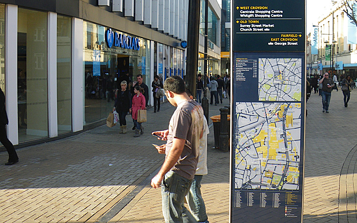
Midilith in Croydon -
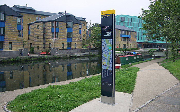
Midilith along a canal towpath -

River interlith at Westminster -
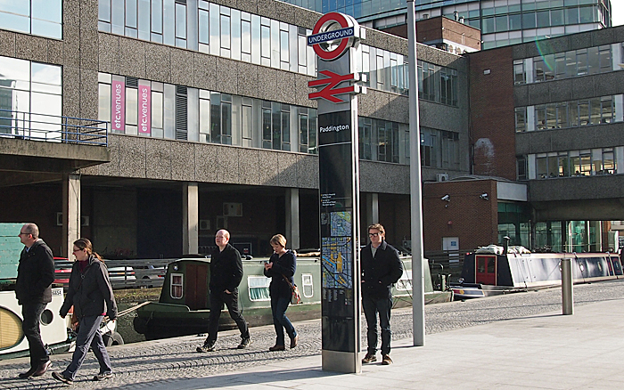
Interlith station totem at Paddington -
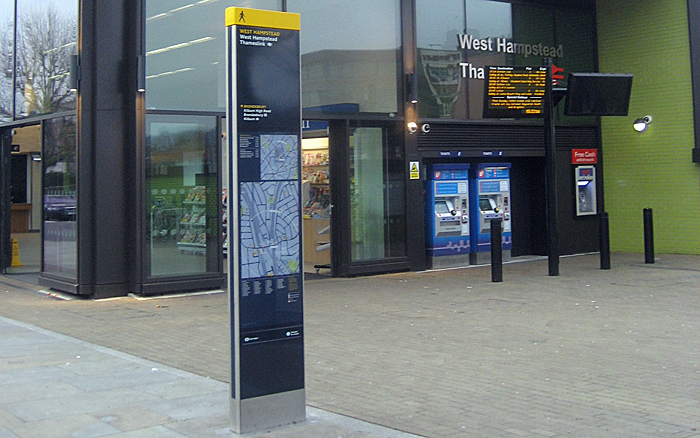
Midilith at West Hampstead -
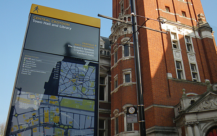
Monolith in Croydon -
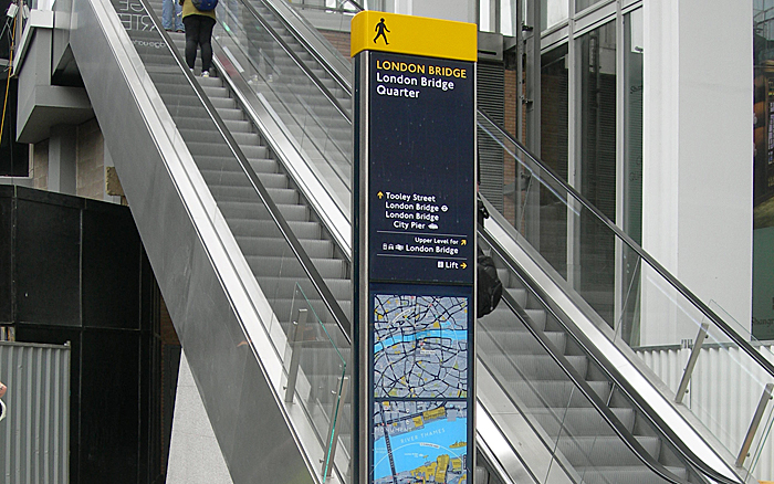
Minilith at London Bridge -

Digilith at Canary Wharf -
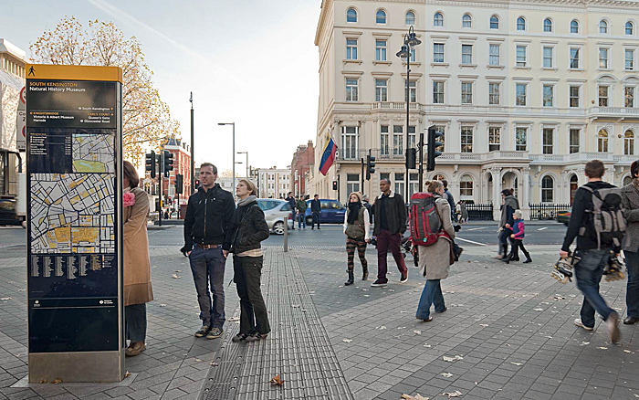
Monolith in South Kensington -
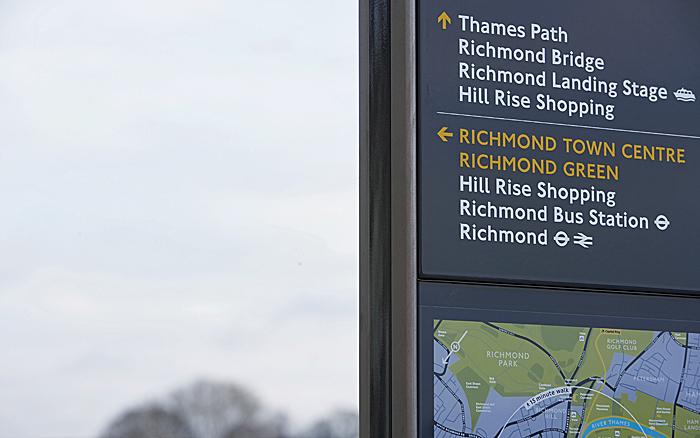
Directional information and 15-minute map -
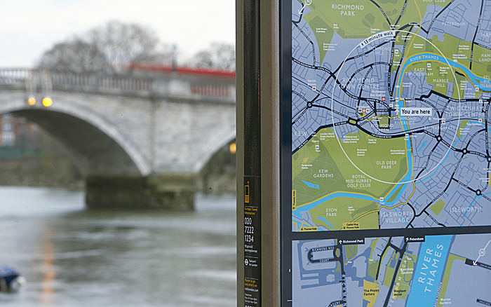
15-minute map -
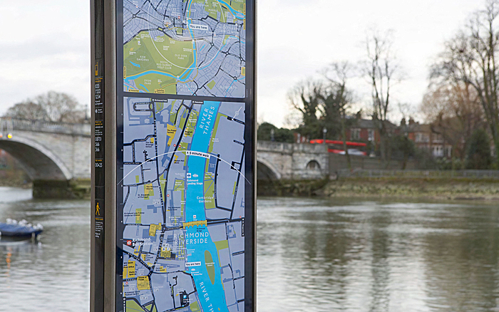
15-minute and 5-minute map -
Minilith outer in Richmond
Legible London product range
There is a core product range of Legible London signs to suit the surrounding streetscape and users' information needs. We are constantly expanding this range so please contact us if you would like to explore using a more specialised product.
Monoliths
These wider signs include detailed directional information and a large walking map to illustrate a five-minute walk in any direction. They are used where groups of people can stand without blocking the path of others.
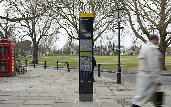
Miniliths and midiliths
These taller, narrower signs offer detailed information on the local area but are useful where pavement space is at a premium. Their height ensures they are visible from a distance and can be spotted above a crowd of people.
Interlith totems
These tall signs combine detailed directional information and walking maps with an illuminated beacon. Designed to be used at transport interchanges, such as stations and river piers, they condense the number of signs required at these locations.
Finger posts
These are more traditional signs pointing the way to places where a map-based sign may not be suitable.
Wall-mounted signs
To meet possible location constraints, a range of wall-mounted signs that follow the Legible London branding, are also available.
Digital signs
Any of the liths can also be adapted to incorporate intelligent transport devices, such as interactive displays, data live feeds, digital displays and touch screens, motion sensors, CCTV, ticket machines and journey planners, WiFi, bluetooth and much more. This can be retrofitted into existing units as long as there is an available power supply.
All signs use high contrast colours so they can be read easily. Each sign is clearly identified with a yellow strip at the top and a walking person icon.

Map features
'Heads-up' mapping
Rather than having north at the top, on-street signage maps are 'heads-up', which means they're orientated to face the same way as the user is facing. This helps people understand their immediate environment more easily.
Accessibility
Important information is located between 90cm and 180cm above the ground so it can be easily read by most people. Among other things, the maps show steps, pavement widths and pedestrian crossings, which are important for visually-impaired people, wheelchair users and others with limited mobility.
Time to walk
Research shows people can more easily understand the proximity of places if they know how long it will take, rather than the distance they have to travel. This is why we use time as the scale for Legible London maps.
Walk this way
Directional information is used to point the way towards areas of London, as well as specific attractions.
3D buildings
Illustrations of key buildings are included to help people who struggle to read maps, including those with learning difficulties. They provide a literal representation of key landmarks and make the maps more intuitive.
Planner map
The planner, or 15-minute, map helps orientate the user by showing the proximity of 'villages' to each other. This helps give the user the confidence to try longer walking journeys. The 15-minute walking circle indicates places that can be reached within that time, when walking at an average pace.
Finder map
The finder, or five-minute, map is more detailed than the planner map and features a number of landmarks, to help guide the user towards specific streets and attractions. It includes a five-minute walking circle indicating places that can be reached within that time, when walking at an average pace.
Integrated transport
Bus stops, Tube stations, Santander Cycles docking stations and taxi ranks are all included.
Street finder
Street names are listed in alphabetical order to help people locate individual streets, as they would with other maps.
Maintaining maps and signs
Legible London signs are owned by either us, the local authority or private organisations. The asset owner is responsible for the maintenance of the sign. If you notice any damage or vandalism to a sign, please email legiblelondon@tfl.gov.uk with an image of the sign, a detailed location and its unique ID if possible (found on the side panel of the sign) and we can direct the query to the relevant owner.
We maintain and update the Legible London base map. The sign map panels are taken from this pan-London mapping database. If you would like to request a map update, please email legiblelondon@tfl.gov.uk. How often a map is updated depends on the scale and significance of the change, for example a new large development.
Requesting new retail names
The maps are designed for wayfinding only, not to advertise attractions. Adding a business to the base map is reviewed on a case by case basis. A business in a given area may be included on the map as a landmark for wayfinding if the area doesn't have many other landmarks, but would not be included automatically.